
Weather station
The Department of Earth Sciences has a weather station operational within the city of Gothenburg, placed on the roof of the building Natrium, Medicinareberget, since August 2024. Data from this location is downloaded and updated once per hour. The station on Natrium was previously located at Geovetarcentrum. Wavrinskys plats, since the 1990s. Old data can be downloaded via this web page.
Information about the data
Data acquisition is made using a Campbell Scientific CR10 logger at a samplig interval of 10 seconds and an averaging period of 5 minutes. Central European time CET (UTC + 1 ) is used for the measurements (i.e. daylight saving included).
Roof station Natrium
The station is located on the roof of the building Natrium, Medicinareberget, at 75 meter above sea level.
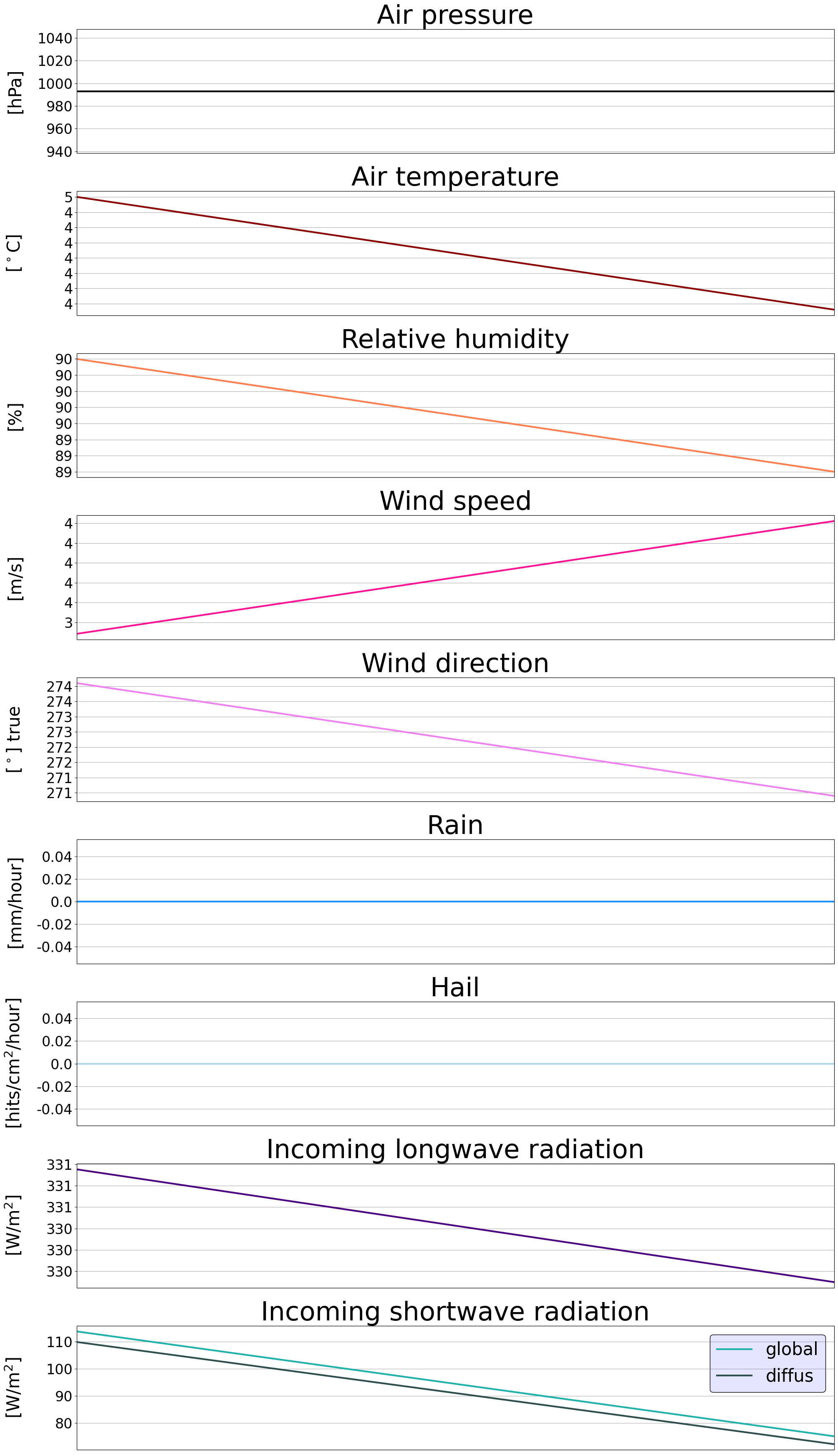
The station currently includes:
- Wind speed (WXT210)
- Wind direction (WXT210)
- Air temperature and humidiy (WXT210)
- Precipitation (Ahlborn)
- Incoming shortwave radiation (DeltaT, SPN1)
- Incoming longwave radiation (Kipp & Zonen, CM3)
Here you find the latest data from the roof station at Natrium
Here you can find a plot showing measurements from the last four days
Old climate data
Here you can download monthly tab-separated textfiles from the roof station at Natrium
Here you can download monthly tab-separated textfiles from the roof station at Geovetarcentrum

Bridge Station
The station Älvsborgsbron is no longer in use but data from 1998-2022 can be reached via the link below.
Data from bridge station Älvsborgsbron 1998-2022
The station included:
- Wind speed (Visala, WXT210)
- Wind direction (Visala, WXT210)
- Air temperature (Visala, WXT210)
- Precipitation (Visala, WXT210)
- Pressure (Visala, WXT210)
- Water level
