New method maps how ice shaped landscapes on Mars
The significance of ice in determining what the Mars landscape looks like is a bit of a mystery. A new method is now increasing our understanding of how ice affected the landscape on the northern plains of Mars.
The northern region of Mars is made up of several low-lying plains filled with sediment. Researchers assume that these areas were formerly covered by an ancient sea.
“Currently these areas are dominated by soil-bound ice, even at latitudes where ice is not in balance with the current climate,” says Andreas Johnsson at the Department of Earth Sciences, University of Gothenburg.
Along with an international research team, he has developed a new method to find answers to unsolved questions about climate and landscape development on Mars.
Ice origins shrouded in mystery
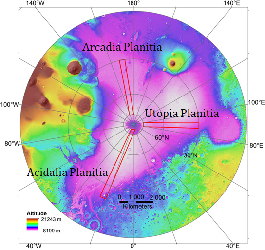
Researchers have investigated the areas of Utopia, Arcadia and Acidalia Planitiae on the planet’s northern plains.
 It is not known if a vanished sea or ice ages in more recent geologic times gave rise to the ice here. Nor do researchers know how old the three surface areas are.
“It takes a very long time to map the landscape of Mars in small-scale areas associated with the presence of ice over large areas. Therefore, we have developed a new method that divides the landscape into 20x20-km squares over a strip 300-km wide from east to west on northern Mars.”
The combined squares provided a bigger picture that the researchers have analysed. This is the first contiguous mapping of the landscape of northern Mars.
Mapping improves understanding
Detailed studies show that soil-bound ice occurs almost everywhere in the three low-lying plains that have been investigated.
“With the new method, we can map very large geographical areas on Mars in less time than before and get a better overall picture of the landscape as well. We also found new landforms that have not previously been described or analysed,” says Johnsson.
Sediment rich in ice that is several metres thick covers large parts of Mars. It is young in geological terms and believed to have been formed from frozen water and tiny airborne particles. The studies show that the distribution of this sediment in the three areas that have been investigated varies.
“Through supplementary radar measurements, we were able to identify soil-bound ice that is much older than the sedimentary covering. The older ice has different distribution in these three low-lying plains.”
He believes that the study paves the way for more detailed studies of recent climate and geological developments on Mars.
 “All in all, the study shows that the northern plains landscape on Mars is a region with a complex distribution of soil-bound ice. Landforms associated with frozen water on Mars and their age are extremely interesting because they enable us to understand climate shifts over a period of time. Ice is also important in questions about life on Mars, and also as a resource for future manned missions to Mars.”
The research project has been made possible by support from the International Space Science Institute (ISSI) in Bern, and the three-part study has been published in the Journal of Geophysical Research – Planets.
Title: Gridmapping the Northern Plains of Mars: A New Overview of Recent Water‐ and Ice‐Related Landforms in Acidalia Planitia.
Contact:
Andreas Johnsson, Department of Earth Sciences, University of Gothenburg; telephone: +46 (0)31-786 29 43, mobile: +46 (0)705-20 50 88, e-mail: andreasj@gvc.gu.se
Photo:
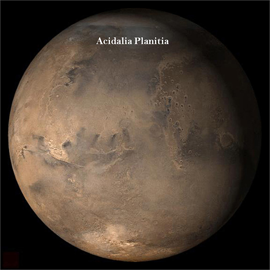
The image shows one of the investigated areas called Acidalia Planitia. Image credit: NASA/JPL/Malin Space Science Systems
Figure: The three studied areas on Mars (red boxes)
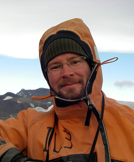
Portrait of Andreas Johnsson, photo GU.
References:
Séjourné, A., Costard, F., Swirad, Z. M., Łosiak, A., Bouley, S., Smith, I., et al. (2018). Grid‐mapping the northern plains of Mars: using morphotype and distribution of ice‐related landforms to understand multiple ice‐rich deposits in Utopia Planitia. Journal of Geophysical Research: Planets, 123. https://doi.org/10.1029/2018JE005665
Ramsdale, J. D., Balme, M. R., Gallagher, C., Conway, S. J., Smith, I. B., Hauber, E., et al. (2018). Gridmapping the northern plains of Mars: Geomorphological, Radar and Water‐Equivalent Hydrogen results from Arcadia Plantia. Journal of Geophysical Research: Planets, 123. https://doi.org/10.1029/2018JE005663
Orgel, C., Hauber, E., van Gasselt, S., Reiss, D., Johnsson, A., Ramsdale, J. D., et al. (2018). Gridmapping the Northern Plains of Mars: A New Overview of Recent Water‐ and Ice‐Related Landforms in Acidalia Planitia. Journal of Geophysical Research: Planets, 123. https://doi.org/10.1029/2018JE005664