
Satellite data over the Swedish mountains provides new information on the health of the vegetation
A new type of satellite will help researchers detect changes in the nutrient content and biochemical properties of plants and soil in the Swedish mountains.
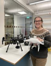
– Using data from the new satellites, we hope to get a clearer picture of what is happening to Sweden's sensitive tundra vegetation due to climate change, says Heather Reese, researcher at the University of Gothenburg.
So-called hyperspectral satellite data is a current and growing field of research. The new satellites launched into space observe more than 200 narrow wavelengths, allowing researchers to gain new insights into the biochemical and biophysical properties of vegetation.
– During this decade, several hyperspectral satellites will be launched into space. This means that a large amount of new data will soon be in place that can give us better information on how the vegetation is doing in areas like the Swedish mountains, says Heather Reese.
In a new research project funded by the Swedish National Space Agency, she will use more advanced satellite data from the so-called "EnMAP" satellite to observe the effect of climate change on tundra vegetation and biodiversity over time.
Data from other satellites are already being used to observe changes in tundra vegetation across the Arctic, but with much lower spectral resolution. From previous studies, researchers already know that the tundra is sensitive and reacts to climate changes affecting large parts of the Arctic. Increased temperatures, changing season length and changing precipitation patterns affect plant health, biomass and species composition. In some areas, tundra vegetation responds by increasing its biomass, while in other areas the vegetation is damaged or dies.
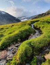
Together with other researchers, Heather Reese has identified areas in the Swedish mountains that are affected by increased temperature, changes in soil moisture and other climate effects. It is in these areas that the project will now test the hyperspectral satellite's ability to provide new information on the vitality of plant communities.
– I hope that the results of this research will benefit the Swedish Environmental Protection Agency, the reindeer-herding Sami population and the Swedish Civil Contingencies Agency, which works with drought and fire risk," says Heather Reese.
The study "Hyperspectral data detect climate impact on tundra vegetation" will run from 2024 to 2029. The research will focus on study areas in Sweden, but also has a global connection to other research projects studying tundra vegetation.
For further information, please contact:
Heather Reese, Associate Professor of Remote Sensing and Geographic Information Systems, University of Gothenburg, Department of Earth Sciences.
e-mail: heather.reese@gu.se
BY: JENNY MEYER DANEBACK